 |
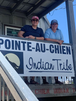
Alyssa Outhwaite (left) and Becky Allee (right) in front of the
Point-au-Chien Indian Tribe Building |
Hi! My name is Alyssa Outhwaite, I am a NOAA EPP/MSI CCME-II Scholar
and a PhD candidate in Marine Biology at Texas A&M University-Corpus
Christi. But what I’m really here to talk about is the amazing summer I spent
as a NOAA EPP/MSI Experiential Research and Training Opportunity (NERTO) intern with
the Gulf Region’s Office for Coastal Management.
This summer, I had the opportunity to work with the Pointe-au-Chien Indian Tribe (PACIT) of
Terrebonne Parish, LA. I learned about their history and how lands have changed
in the face of exploitation. I learned about their devotion to their homes and
perseverance to maintain the important culture of their tribe in a changing
world. Together we considered how alternative oyster culture (AOC) may be used
to enhance social equity and environmental justice among their people. AOC is a
potential sustainable way of growing oysters, where oysters are grown and
harvested in bottom-placed or floating cages. While traditional
oyster culture farming has been the way of the PACIT for generations, the
concept of AOC is a relatively new one, and Louisiana in particular is
interested in growing this industry.
As a part of this
internship, I received hands on experience working with the tribe as well as
behind the curtain operations of NOAA’s Office for Coastal Management. I was
able to collaborate with the federal government, state agencies, and the local
tribe to better understand the condition of Louisiana’s bayous, erosion
concerns, and where AOC might fit into that changing landscape. We started by
asking a simple question “are there suitable areas in which AOC can take place
that will benefit the PACIT?” This led me through a journey of mapping out
priority lands for the tribe and oyster leases in adjacent waters.
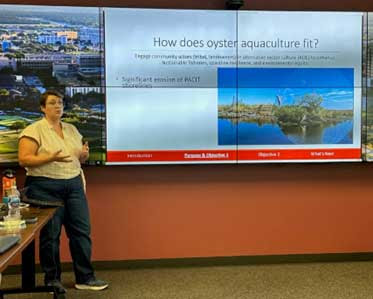 |
| Alyssa Outhwaite giving a presentation on oyster aquaculture to the NOAA Gulf Region Collaboration Team |
 |
Donald Dardar (back left), Matt Bethel (back right),
Earl Melancon (front left), and Alyssa Outhwaite (front right)
surveying oyster leases in Terrebonne Parish Louisiana |
One of my favorite experiences this summer was cruising out
into the bayou with a couple of the tribe’s oystermen to survey oyster leases,
where we documented the water’s temperature and salinity using a sonde, which is an instrument that transmits information about its surroundings from an inaccessible location such as underwater.
We made
a little competition of tasting the water before checking the salinity to see
how close our guesses were to truth. For two experienced oystermen, I wasn’t
surprised how spot on their estimates were.
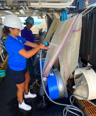
From there we poled the water bottom to document the
substrate type. ‘Poling’ an oyster lease is actually quite simple. One must
simply possess the ability to balance along the deck of a boat, spearing their
rod down into the water to the sediment below, and shout back to person holding
pen and paper what sort of bottom lay underneath. ‘Mud’ for the soft and
sticky, ‘Firm’ for the more unyielding, and ‘Reef’ for the clumps of oysters
easily discerned by the shifting clink of the pole as it taps across shells.
And you simply do this repeatedly as the boat captain motors steadily across
the water. The end result is a profile of the bottom type, which is important
for determining how well an oyster farm might fare.
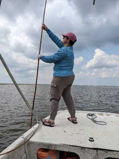 |
Alyssa Outhwaite surveying oyster lease bottoms by
"poling" in Terrebonne Parish, Louisiana |
Returning to the tribal building to eat pot-fried crabs and
listen to stories about the tribe, their legacy of living in the bayou, and how
hard they work to keep moving forward was one of the most enriching experiences
I’ve had.
This opportunity went far beyond learning more about NOAA
and preparing me for a future in that industry. It helped me connect the
important science we do to the people it impacts. It helped me better see where
management can make a difference and how there is so much work that can be done
for the underserved communities right in our own bayous.
______________________________________
Alyssa's NERTO internship was made possible by the National Oceanic and Atmospheric Administration (NOAA) Office of Education, Educational Partnership Program with Minority-Serving Institutions award #NA21SEC4810004 (NOAA Center for Coastal and Marine Ecosystems-II). The contents of this post are solely the responsibility of the award recipient and do not necessarily represent the official views of the U.S. Department of Commerce, NOAA.


